top of page


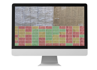
Color Coded Plotting
Stay organized with custom color plot statuses.
Access Your Maps Anywhere
Desktop, tablet, or mobile phone. Access your cemetery maps anywhere.
Find Records Instantly
Easily locate any section, lot, grave, or name in seconds. No more looking at paper maps or walking the cemetery grounds.


Our Cemetery Mapping Process
1
On-Site Scanning
We travel to your cemetery to scan or photograph your paper records, and maps.
2
Burial Verification
We walk the cemetery grounds to document the exact location of each memorial.
3
Drone Works
While on-site, our cinematic quality drone captures a high resolution image of your cemetery to replace to satellite image for mapping purposes.
4
Data Transcription
5
Digital Mapping
Our data team enters and organizes the paper data into a searchable, digital database.
We build a detailed, interactive map linked to all of your cemetery records.
6
Delivery & Training
You receive your digital cemetery software with training and ongoing support.

"Lazarus Cemetery Mapping did a thorough and very professional digital mapping of our Catholic cemetery
which serves several parishes of the town of Jasper, Indiana. All the clergy who are on the local cemetery board were quite pleased with their work. Their prices are extremely affordable. Please consider them for your cemetery mapping needs!"
-Fairview & St. Joseph / Jasper, IN
Related Case Studies
bottom of page